<<<<<<<<<<<<<<<<<
http://otheraberdeen.blogspot.com/2011/05/20th-century-boundary-stones-acb.html
2011.05.30
...suppose we should really get ourselves along to the local studies department at the Central Library and see if we can look at a mid-20th century map for clues to where we might find others of these 20th century boundary stones, but hey - this isn't a job! (Nevertheless - if anyone's got a copy of such a map that they can let us have we'd be really grateful.)
<<<<<<<<<<<<<<<<<<<<<<<<<<<<<<<<
20th century boundary X Inbox X Reply
from xxxx@yyyyy.com
to otheraberdeen@gmail.com
date Fri, Jun 10, 2011 at 9:44 PM
subject 20th century boundary
att 1 Attachment 421kb
Hi, saw your request for a map with indication of Aberdeen's boundary before 1975 and thought that this might help. (SEE ATTACHED)
Regards
xxxxxANONxxxxx
<<<<<<
1 Attachment 421kb proposals.jpg
#######################################
As so often happens in life, when we go looking for one thing, we find something else; something more distracting, perhaps. Something enlightening, something fascinating.
In this case the map document "THE-CITY-AND-ROYAL-BURGH-OF-ABERDEEN, Survey and Plan ~ 1949, ROAD COMMUNICATIONS. PROPOSALS" opens up a door into the minds of the post-war town planners and their fever-dream visions of the future; it is a wee postcard from the centre of the car-crazy 20th century. It isn't really a map (maybe it's a "mind map") rather it's a disingenuous presentation of a schematic diagram made to look like a true map. It takes quite serious topological liberties with topographical realities. Having thrown topographical reality to one side, our post-war planners dared to dream big.
Three ring-roads; a gyratory system at Holburn Junction/Rose St/Thistle St; much of Ferryhill demolished for an inner city motorway (in all but name); a high-speed radial expressway cutting Cragiebuckler in two to link Countesswells Road at Hillhead with Queens Road at Hill of Rubislaw (the undeveloped green corridor for this pupative expressway exists to this day). Three ring roads.
Even in their wildest car-crazy dreams the post-war planners in London only ever envisaged a maximum of four concentric ring-roads for the capital.
 |
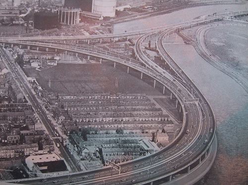
| pic from Wikimedia Commons |
 |
| Predict and Provide |
Predict (traffic levels) and provide (capacity beyond that) was the tenet of these mid-century promethean would-be road-builders: iconoclasts, they would destroy the city to create it anew. A new order beckoned and all round the world the social, economic and political decks were being shuffled. The externalities of unchecked motor vehicle growth had not yet impinged upon the considerations of these utopians, instead they saw a future painted in the broad bold strokes and interplanetary proportions of what we today recognise as being nothing but science-fiction. So (concurrent with Dr Beeching's noticing that railways were old fashioned and best done away with) in his 1963 report
"Traffic in Towns" Professor Sir Colin Buchanan mused:
 |
In the future: the British Empire's
borders extend all the way to Venus |
The possibility most usually canvassed is that within a measurable time some kind of individual jet-propulsion unit will be developed, of which a rudimentary form has already been tried out in the U.S.A. for military use.
But sensible Sir Colin went on to question the individual jet-pack's viability as a means of daily transport for commuters, and concluded, therefore, that the only possible future was one of comprehensive grand-plan redevelopment to make more and more room for cars -
Jellicoe's "Motopia".
 |
The way it turned out for us at the
Denburn Road "improvement". |
But Prof. Buchanan did reach ahead of his time and recognise that increases in road capacity can actually exacerbate congestion problems:
The problems of traffic are crowding in upon us with desperate urgency. Unless steps are taken, the motor vehicle will defeat its own utility and bring about a disastrous degradation of the surroundings for living... Either the utility of vehicles in town will decline rapidly, or the pleasantness and safety of surroundings will deteriorate catastrophically – in all probability both will happen.
At the time these words were written, they were not, but the mechanisms of network-induced demand are now well known, are within the body of established empirical science and are regarded as
The Fundamental Law of Road Congestion. Indeed, in the United States, where much highway (motorway and dual-carriageway) infrastructure is now approaching obsolescence, planners are discovering that removal of these artifacts from the centre of the car-crazy 20th century has major economic and social benefits for cities.
>>>>>>>>
Professors Gilles Duranton and Matthew Turner analyzed travel data from hundreds of metro areas in the U.S., resulting in what they call the most comprehensive dataset ever assembled on the traffic impacts of road construction. They write:
For interstate highways in metropolitan areas we find that VKT [vehicle kilometers traveled] increases one for one with interstate highways, confirming the “fundamental law of highway congestion” suggested by Anthony Downs (1962; 1992). We also uncover suggestive evidence that this law may extend beyond interstate highways to a broad class of major urban roads, a “fundamental law of road congestion”. These results suggest that increased provision of interstate highways and major urban roads is unlikely to relieve congestion of these Roads.
>>>>>>>>>>>>>>>>
Milwaukee spent $25 million to demolish the 1-mile-long Park East freeway, while it would have cost $100 million to rebuild that 30-year-old freeway. Removing the freeway opened 26 acres of land for new development, including the freeway right of way and surface parking lots around it, which have already attracted over $300 investment in new development, in addition to stimulating development in surrounding areas.
San Francisco increased nearby property values by 300 percent by tearing down the Embarcadero Freeway and opening up the waterfront, stimulating the development of entire new neighborhoods.
Niagara Falls is removing the Robert Moses Parkway in order to slow people down and encourage them not to drive as far. Just as building this parkway encouraged tourists to take longer trips and drive right through to Niagara Falls, Canada, removing this parkway is meant to encourage tourists to take shorter trips and stop in Niagara Falls, New York.
~~~~~~~~~~~~~~~~~~~
But such counter-intuitive cognitive-dissonance-inducing facts do not go down well here, where we plan the
Aberdeen Western Peripheral Route "special category" bypass road (a motorway in all but name) and the
Berryden Corridor "Improvements" (an urban dual-carriageway radial expressway scheme).
Notable amongst the justifications and rationalisations for work on both the new ring-road and the new urban dual carriageway are promises of "improved journey times". This flies in the face of the UK Department for Transport which, as long ago as 1996 adopted
guidance documents stating that cost-benefit studies on new road building schemes must assume that elasticity of demand may be as high as 1.0 with respect to speed. Which is to say that the average trip length increases as much as speed increases: building roads which reduce journey times merely serves to lengthen the average trip taken; with the same amount of time being spent behind the wheel, the number of driver-miles increases. The very essence of induced demand.
>>>>>>>>>>>>>>>>
Reducing journey times in and around and to and from the North East not only improves quality of life for individuals but helps retain and attract businesses who need reliable connections to their markets in order to survive.
<<<<<<<<<<<<<<<<<<<
Aberdeen City Council
Frequently Asked Questions
How does losing a part of school playground improve health?
The alignment of the carriageway alongside the school was chosen in order to meet the design requirements for roads and to avoid the demolition of property on the other side of the road. The design of roads in an urban environment can be restrictive and at times compromises have to be reached.
<<<<<<<<<<<<<<<<<<<
Aberdeen City Council
Frequently Asked Questions
Why are you creating a motorway through the city?
The dual carriageway route proposed for the Berryden Corridor permits a number of transport modes and can be successfully integrated into an urban environment. It will have a speed limit of 30mph like the majority of the urban roads in Aberdeen. The Berryden Corridor Improvement Project makes up part of an integrated transport system for Aberdeen City, which includes projects such as;
The Aberdeen Western Peripheral Route (AWPR), the construction of which will reduce unnecessary traffic travelling through Aberdeen, freeing up capacity in the city centre
Union Street pedestrianisation and its associated traffic management.
A number of studies to investigate how to better manage and improve the transport system around the city [...]
Feasibility studies to investigate cycle routes on the Anderson Drive, Inverurie Road and King Street/ Ellon Road corridors.
A Bus Action Plan
A freight action plan
A Car Parking Strategy, which aims to increase charges in the city centre and extend the controlled parking zone.
[...]
All of this assists the Council in meeting its policy and environmental commitments.
###########
Poised like an arrow pointing at the heart of the city centre, the new urban dual carriageway will deliver high volumes of high speed traffic into the centre of our town, and through the agencies of their action plans, studies and strategies our planners expect us to believe that this will "assist" schemes like the 30-year-promised pedestrianisation of Union Street. Pedestrianisation and modal switch to cycling, walking and public transport is achieved by discouraging motor traffic, by re-allocating aspects of the urban environment away from cars, not by ushering in more.
We only have to observe the bleakness & utter desolation of the entire length of East/West North Street, from Mounthooly to the Castlehill roundabout, to realise the destructive futility of this outdated slash-and-burn approach to town planning, with its demented prioritisation of an accelerated flow of vehicular traffic above every other consideration. How many streets, houses and communities were destroyed to accommodate the East/West North Street urban motorway? And there is a cluster of nice little residential streets such as Caroline Place near the former Rosemount Church, really a kind of urban village, standing in the way of the proposed Berryden Junction!
<<<<<<<<<<<<<<<<<<<<<
The number of cars, buses and lorries using the key roads in and out of [Aberdeen] has fallen to its lowest level for years.
Surprising new figures suggest traffic levels on Aberdeen’s congested major roads may be dropping after reaching saturation point. Experts linked the findings to the growing use of trains and bikes in an age of increasing environmental awareness and economic austerity, as well as commuters sharing cars or finding quieter routes in to work.
Transport chiefs warned against complacency and said the city’s bypass must be delivered, as well as a third bridge over the Don and a solution at the notorious Haudagain roundabout.
Councillors in Aberdeenshire were certain commu-ters had not witnessed a reduction in rush-hour congestion, even if vehicle totals on the roads had fallen.
Data from Transport Scotland, under freedom of information legislation, reveals the five-day weekly average number of vehicles using Aberdeen’s trunk roads for every month in the last 20 years.
After huge growth during the 1990s, the traffic volumes appeared to stabilise over the last decade and have even started to fall.
>>>>>>>>>>>>>>>>>////////////
After Aberdeen's traffic density had reached a maximum a few years ago, it then subsided back and our town planners and their business sponsors decided that attracting more traffic to the town centre should actually become the desireable outcome. And so they dusted off those ill-conceived plans from the centre of the car-crazy 20th century and today they push on ahead with a re-hash of the 1949 plans for orbital motorways and urban dual carriageways. They seek to induce demand, to pander to the car-dependent addiction of the polity. Is this the most car-sick town in Europe?
The solipsism of the roadbuilders' logic is circular tail-chasing devastation.
1960's
Is there going to be too much traffic? Better build urban dual carriageways and motorway ring-roads.
2010's
Is there not going to be enough traffic? Better build urban dual carriageways and motorway ring-roads.
<<<<<<<<<<<<<<<<<<<<<<<<<
http://en.wikipedia.org/wiki/Automobile_dependency
Automobile dependency implies that cities where automobiles are the predominant transport deny their residents not only freedom of choice about the way they live and move around the city but also that the culture of automobile use has produced a kind of addiction to them. The analogy is made with addictions to harmful substances and activities because of the well-known law of diminishing returns in relation to increasing use or participation: the more that is used, the less of the desired effect is gained until a point is reached where the substance or activity has to be maintained to remain 'normal', a state of dependency.
When it comes to automobile use, there is a spiralling effect where traffic congestion produces the 'demand' for more and bigger roads and removal of 'impediments' to traffic flow, such as pedestrians, signalised crossings, traffic lights, cyclists, and various forms of street-based public transit such as streetcars (trams).
These measures make automobile use more pleasurable and advantageous at the expense of other modes of transport, so greater traffic volumes are induced. Additionally, the urban design of cities adjusts to the needs of automobiles in terms of movement and space. Buildings are replaced by parking lots. Open air shopping streets are replaced by enclosed shopping mall. Walk-in banks and fast-food stores are replaced by drive-in versions of themselves that are inconveniently located for pedestrians. Town centres with a mixture of commercial, retail and entertainment functions are replaced by single-function business parks, 'category-killer' retail boxes and 'multiplex' entertainment complexes, each surrounded by large tracts of parking.
These kinds of environments require automobiles to access them, thus inducing even more traffic onto the increased roadspace. This results in congestion, and the cycle above continues. Roads get ever bigger, consuming ever greater tracts of land previously used for housing, manufacturing and other socially useful purposes. Public transit becomes less and less viable and socially stigmatised, eventually becoming a minority form of transportation. People's choices and freedoms to live functional lives without the use of the car are greatly reduced. Such cities are automobile dependent.
~~~~~~~~~~~##################~~~~~~~~~~~~~
An tiny little old lady tries to cross the road at the t-junction, peering round the wing of the big silver-grey SUV to try to check it’s OK to cross, and to try to make herself seen to the motor traffic using the junction. She waits, and waits, and waits.
Inside the house, a rivulet of running sweat tickles as it begins to trickle down his spine between his shoulderblades as he flollops into the sofa and reaches grunting over his belly swapping the clunky chunk of the black plastic carkey electronic transponder for the skybox remote control. Flips to EPG; pagedown pagedown pagedown. Pagedown. Huh! Nothing - saturday lunchtime. He puts the sweat-finger smeared remote down on the sofa arm and, getting his breath back after walking from the car, puffs hard, blowing his cheeks out. His eyes swivel first, then his head, then his body to look out the window. There it is. He got it two years ago, he knows the exact date, it’s the exact same age as his youngest daughter; his wife was in the maternity unit. She was there while he got his baby. Got the cherished plate transferred over from the older model (this one’s a serious upgrade) LYN 684, that’s in honour of his wife - she likes that.
Saturday and sunday its OK to park it there - no traffic wardens about at the weekend. He loves his end-terrace house (now after about five years he’s got it just the way he likes it), but it has its problems. To his chagrin, traffic regulations mean that, because his house is on the t-junction, he can’t pave over the front garden and turn it into a parking bay, the way his neighbours have done. That’s harsh, particularly as those same traffic regulations have double-yellows immediately outside the house - so he can’t park there; can’t park where he can see the car from the sofa - one eye on the adverts, the other on the Audi. Sometimes he even has to park round the corner up to a hundred metres away. That can be quite a walk, particularly for his eldest daughter - she’s six now, and not used to such distances. But, come the weekend, the wardens retreat and he parks his own car outside his own house, just as he should. To hell with the double yellows: Ford’s in his flivver; all’s well with the world. He can look at it as much as he wants. If he could, he’d park it in the living room.
What’s that? In the corner of his field of view, somebody’s near his car! It’s just as well he parked it there so he can see who’s interfering with his property! He levers himself up and, pulling the airtex front of his too-small poloshirt back down over his paunch, waddles to the bay window. It’s an old lady, just standing. Standing right beside his car, her right hand out by her side, as if she might touch the bonnet at any moment. He hammers his fist on the windowpane - nothing. Face reddening, slack-jawed, wide-eyed he thumps again, bangbangbangbangnbang! Still nothing. Is she ignoring him? He squeezes slather-footed between sofa and TV and hurries out the door, down the hall, out the front door. He looks at the car but he can’t see the woman. Where is she?

http://www.marchandmeffre.com/detroit/index.html
http://www.wesleyjohnston.com/roads/belfasturbanmotorway.html
http://www.hiddenglasgow.com/forums/viewtopic.php?t=642
http://en.wikipedia.org/wiki/Traffic_in_Towns
http://hc110-2.blogspot.com/
http://dc.streetsblog.org/2011/05/31/study-building-roads-to-cure-congestion-is-an-exercise-in-futility/
http://www.nottingham.ac.uk/transportissues/uktp_history.shtml
http://www.preservenet.com/freeways/FreewaysInducedReduced.html
http://waronthemotorist.wordpress.com/2011/01/15/crap-cycling-and-walking-in-car-sick-glasgow/#more-768